
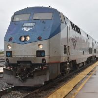
 Welcome to the second instalment of my bonus Travel Spot. Just over a year ago, Amanda and I left Emeryville Station onboard Amtrak Train No. 6, the California Zephyr. A daily service between Emeryville (just across the bay from San Francisco) and Chicago, the California Zephyr has a scheduled journey-time of 51½ hours as it makes its way west-to-east across roughly two-thirds of North America. The first part of this Travel Spot covered our first day on the train, travelling across California’s Central Valley, over the Sierra Nevada Mountains via the Donner Pass and down into and across Nevada following the Truckee and Humboldt Rivers.
In this instalment, we pick up our journey with our first of two nights on the train, which saw us going to bed in Nevada and waking up almost all the way across Utah. We followed the Colorado River for most of the day, crossing into Colorado along to 40 km long Ruby Canyon before climbing up through the Rockies, descending again into Denver as night fell. You can read about the third day of our journey, from Denver to Chicago, in the third and final instalment of this Travel Spot.
Although I’ve split the journey over three posts, one for each day, this is still a very long post, so I’ve further split it into the following sections:
- Superliner Sleeping Compartments
- Breakfast and Ruby Canyon
- Grand Junction and lunch
- Glenwood Canyon
- Following the Colorado to Granby
- Across the Rockies
- Denver
If you want to follow along, then ShareMap has an interactive route map.


 showing its full width.")

 big enough to hold my large rucksack (from the Tucson trip).")


 1
1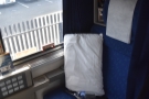 2
2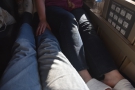 3
3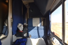 4
4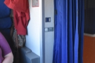 5
5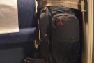 6
6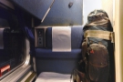 7
7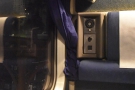 8
8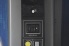 9
9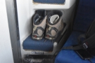 10
10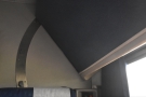 11
11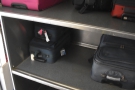 12
12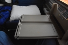 13
13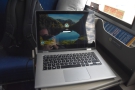 14
14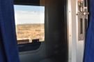 15
15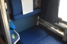 16
16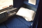 17
17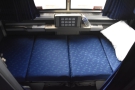 18
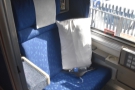
18The California Zephyr uses Amtrak’s Superliner double-decker coaches (in contrast to the tall, single-deck Viewliners that Amanda and I took when we went from New York to Atlanta in March). We’d spent quite a bit of the first day in our little compartment, which was similar to the Viewliner, but had a number of important differences.
We were in one of 10 standard two-person compartments (known as roomettes) located on the upper deck, arranged in two rows of five on either side of the narrow, central corridor. It’s roughly the same length and width as the Viewliner compartments, but isn’t as tall. During the day, when it’s used for seating, this isn’t an issue, but it does have an impact at night.
There’s a lot less luggage space in the actual Superliner compartment since it lacks the large space that extends out above the corridor. There’s also less usable space where you can put things during the day. On other hand, there’s a very large downstairs luggage rack next to the doors where you can leave larger bags, which means that you only need to take a day-bag into the compartment with you. You also have the alternative of checking your larger bags into the baggage car (just as you do on the Viewliners) but then you don’t have access to them for the entire trip.
The Superliner has two wide seats which face each other across the compartment, so you both get a window view, although one of you has to travel backwards all the time (that was me: as compensation, though, I got the bottom berth). Compared to the Viewliner, the seats are wider, particularly since there’s no toilet inside the compartment (which significantly reduced the width of one of the two Viewliner seats). Instead, there are a couple of narrow ledges/shelves which double as steps to the upper berth.
When it comes to converting the Superliner into a bedroom, it’s a relatively simple process. The two seats slide together to form the lower bed, while the upper bed simply folds down to lie flat (when it’s stowed away, it’s at an angle of about 45°, which means that, unlike the upper bed in the Superliner, which lies flat and is lowered up and down, you can’t easily use it to store luggage during the day.
The lower bed (mine) is particularly good and is wider than its Viewliner counterpart, although Amanda says that she felt the upper bed is narrower. Whereas she felt quite secure in the Viewliner, she worried about rolling out of the Superliner bed (which has webbing down the side to prevent this). Due to the lower height of the compartment, neither bed has the same headroom as the Viewliner, while the top bed lacks its own window.
Another difference is that the Superliners don’t have Wifi, and there’s only one power outlet, although that’s slightly better placed in the back of one of the seats, next to the headrest. I found that the lights were poorly placed, often being situated behind me, so that I blocked my own light. They also get very hot and are blindingly bright when you turn around to switch them off. Also, as a general rule (which applies to all Amtrak trains), there is far too much metal, particularly exposed metal edges which aren’t rounded and are easy to cut yourself on.
You can see how we got on during our first night on the train after the gallery.


.")


 1
1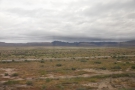 2
2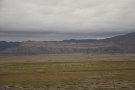 3
3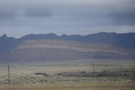 4
4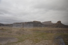 5
5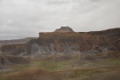 6
6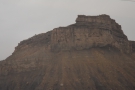 7
7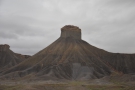 8
8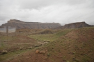 9
9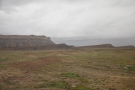 10
10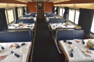 11
11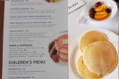 12
12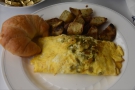 13
13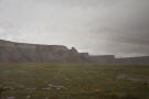 14
14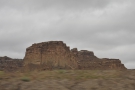 15
15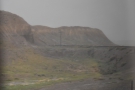 16
16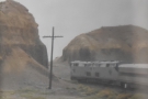 17
17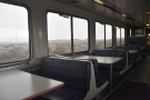 18
18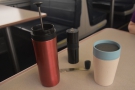 19
19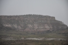 20
20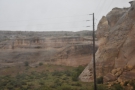 21
21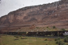 22
22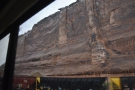 23
23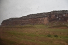 24
24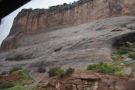 25
25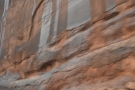 26
26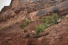 27
27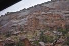 28
28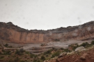 29
29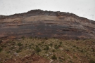 30
30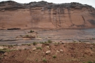 31
31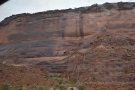 32
32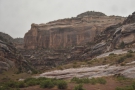 33
33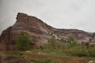 34
34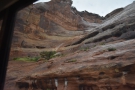 35
35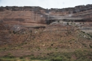 36
36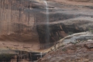 37
37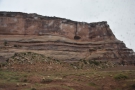 38
38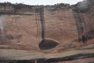 39
39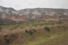 40
40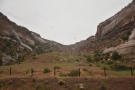 41
41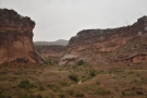 42
42 43
43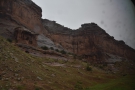 44
44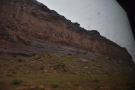 45
45 46
46 47
47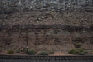 48
48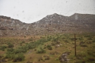 49
49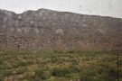 50
50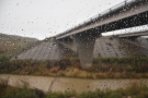 51
51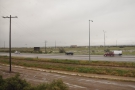 52
52We were travelling across Nevada, following the Humboldt River, as night fell. Our beds had been made up while we were at dinner, largely because it’s easier to do while we’re out of the room, although I note that the sleeping car attendant doesn’t offer this service after 21:00. This is a little bizarre because the train doesn’t go quiet until 22:00, so if you try to get to sleep during that hour, you’re woken by the loud announcements!
While Amanda went to bed relatively early, I stayed up, working on that day’s Coffee Spot, San Jose’s B2 Coffee, while proved to be a mistake, since I lost any data coverage on my phone as we headed into Utah, so I couldn’t upload what I’d written… As a result, I went to bed rather late and rather grumpy, which never helps me sleep! We also lost an hour during the night as the clocks went forward by an hour, the result of going onto Mountain Time when we crossed into Utah. With the announcements starting up again at 07:00 the following morning, it meant that we only had eight hours of quiet time, although if you are going in the other direction, you get a blissful 10 hours of quiet!
As it was, we both slept very poorly, although mine was rather self-inflicted and, once I finally went to sleep at 01:00 (Mountain Time), I slept quite well. Amanda, on the other hand, is not a great sleeper at the best of times and found her first night on a train rather trying. We were both woken by the announcements at 07:00, by which time we’d made our way across most of Utah, first heading east to Salt Lake City (where we left old friend I-80) then going southeast through the mountains towards Green River, where we arrived at 07:50.
I’d just got up at that point, while Amanda had been up 30 minutes before me. We headed for breakfast in the dining car at 08:00, just as we left Green River, Amanda having the pancakes, while I had the omelette. We then went through the lounge car and downstairs to the café to get hot water for our morning coffee.
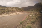
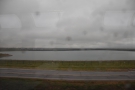
On leaving Green River, we turned east, picking up I-70, which was to be our companion for much of the day. Although it was raining, and the photographs don’t do it justice, Eastern Utah is very beautiful, with interesting rock formations, characterised by long, horizontal layers of with some amazing colours.
Continuing the theme of constant change. the landscape was as different from Nevada as Nevada had been from the Sierra Nevada Mountains and the Central Valley before that on Day 1. In many ways, the rock formations reminded me of those I’d seen in Arizona. We took 1½ hours to cross 115 km of this amazing landscape, picking up the Colorado River along the way, which joined I-70 as that day’s second companion.
At 09:30, we entered Ruby Canyon and crossed into Colorado. Ruby Canyon cuts through more of the amazing rock formations. What makes it more special is that I-70 passes north of the Canyon, so the only way to see it is by train, unless you are prepared to brave the river by raft (which plenty of people do). We’d gone back to our compartment, where, sitting on the left-hand side of the train, we had some spectacular views of the shear rock walls of the canyon, although we missed the heavily swollen river which was on the other side.
In all, it took us 45 minutes to cover the canyon’s 40 km, which included two ten minute halts which may have been to let other traffic through since although the line was dual-track, there was some maintenance going on. After that, we sped quickly on, covering the 35 km to our next stop, Grand Junction, Colorado in just 20 minutes.
You can see how we got on at Grand Junction and beyond after the gallery.


 as our near constant companion.")


 1
1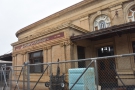 2
2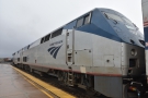 3
3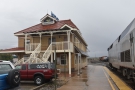 4
4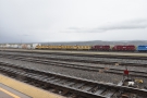 5
5 6
6 7
7 8
8 9
9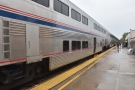 10
10 11
11 12
12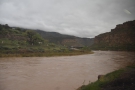 13
13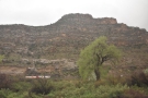 14
14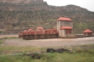 15
15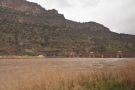 16
16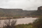 17
17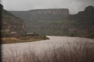 18
18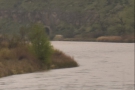 19
19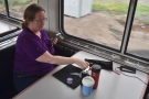 20
20 21
21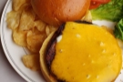 22
22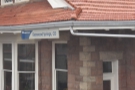 23
23We reached Grand Junction at 10:35, a little behind schedule, but made up a few minutes by not staying for the full 20 minutes that we would usually enjoy at a “smoke stop”. Nevertheless, there was still time to get off and stretch our legs, while plenty of people took the opportunity to visit Dave’s Depot, a convenience store located on the platform itself. I suspect that this was particularly welcome for those who had been limited to the café car’s stock for the previous 24 hours!
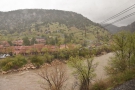
We left at 10:50, 25 minutes behind schedule. From now on, we would be following the Colorado River all the way into the Rockies, which took us along several steep-sided valleys, with more gorgeous rock formations on either side. We were also joined by I-70, which usually occupied the opposite bank of the river. Due to all the rain, this was in flood, rushing down from the Rockies and looking quite magnificent.
Unfortunately, the line went down to a track at this point, with occasional passing loops. Since we were late, we had to wait for a freight train coming down valley, which led to another 15-minute delay. We took advantage of the unexpected stop to have some more coffee, once again using my Travel Press and beans from Peixoto in Chandler, Arizona.
The valley widened a little and we carried on, following the river, with I-70 as our constant companion. By now, we were heading east and, just as the valley began to narrow again at around midday, we headed to the dining car for lunch. For the next 45 minutes, we followed another stunning river valley, but since we were at lunch (at a table of four with two others) I didn’t take any photos. I had the vegan bean burger, which was excellent, while Amanda and I shared a cheesecake for dessert.
We reached our next stop, Glenwood Springs, at 12:50, just at end of lunch, by now running 45 minutes late, having covered the 140 km from Grand Junction in exactly two hours.
You can read about the next stage of journey, the climb through the Glenwood Canyon, after the gallery.


, one of several that flows into the Colorado.")


 calm.")


 tunnel of our own.")


 1
1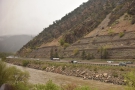 2
2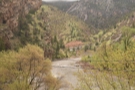 3
3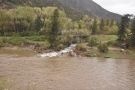 4
4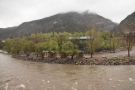 5
5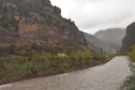 6
6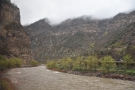 7
7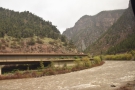 8
8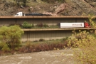 9
9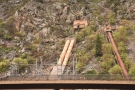 10
10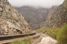 11
11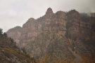 12
12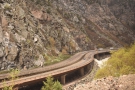 13
13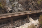 14
14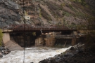 15
15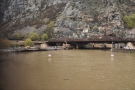 16
16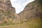 17
17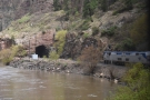 18
18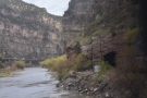 19
19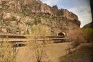 20
20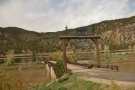 21
21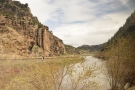 22
22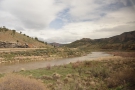 23
23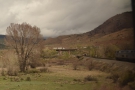 24
24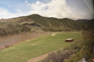 25
25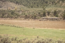 26
26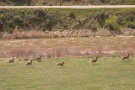 27
27On leaving Glenwood Springs, the train followed Glenwood Canyon climbing all the time. We’d started the day at an elevation of 1,240 m at Green River, reaching 1,400 m at Grand Junction. From there, we’d gained another 350 m on our way to Glenwood Springs, which stands at 1,750 m. However, the next part of the journey would be our steepest climb yet: from Glenwood Springs to the head of Glenwood Canyon was just 30 km, but with an elevation gain of 120 m, a journey that would take us 50 minutes.
All the while we followed the Colorado River, the narrow, steep-sided canyon providing some amazing views. We stuck to the southern bank of the river, while the freeway, I-70, hugged the other side. The only exception to this is a short stretch of the river south of Hanging Lake, where the freeway crosses over to the southern bank before both plunging through a ½ km tunnel under the mountain while the train continues along the side of the river.
For the majority of the ascent, we went really slowly in case there were fallen boulders on the track (which could easily derail the train). The river was amazing, so fast-flowing, particularly in the lower reaches (there is a dam just before the tunnels). It’s a popular white-water rafting area, although we only saw one raft.
We reached the top of the canyon just after 13:30, where the valley widened a little, accommodating the little town of Dotsero, which sits on the confluence of the Colorado and Eagle Rivers. Here we said goodbye to I-70 as it carried on taking an easterly course along the Eagle, taking the more direct route to Denver. Meanwhile, the train turned north, following the Colorado the long way around as we continued our climb into the Rockies.
You can see how we got on after the gallery.


.")
...")


 1
1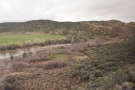 2
2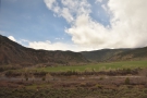 3
3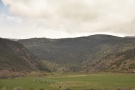 4
4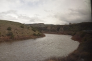 5
5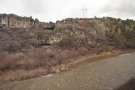 6
6 7
7 8
8 9
9 10
10 11
11 12
12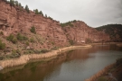 13
13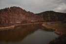 14
14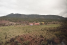 15
15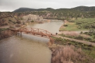 16
16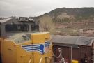 17
17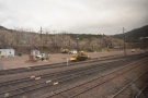 18
18 19
19 20
20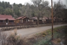 21
21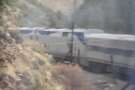 22
22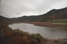 23
23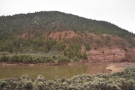 24
24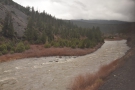 25
25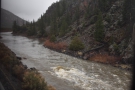 26
26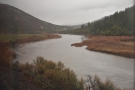 27
27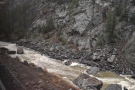 28
28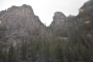 29
29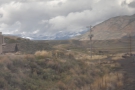 30
30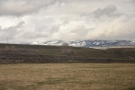 31
31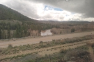 32
32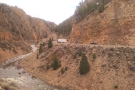 33
33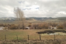 34
34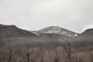 35
35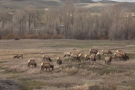 36
36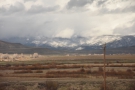 37
37We left Dotsero at around 13:40, the train entering a steep-sided valley as we headed north through the mountains. Amanda and I had a half hour nap at this point, since neither of us had got enough sleep the night before. We awoke at the top of another broad valley, the track following a more direct line as the river meandered along the bottom of the valley, heading northeast.
By now, we were at an elevation of almost 2,000 m and could see the snow-topped peaks of the Rockies in the distance. We entered another narrow, steep-sided valley, lined with red sandstone at various points, gently climbing as we went. After about 15 minutes, the river, and hence the railway line, took a 90° turn to head southeast, part of a southerly loop around State Bridge.
The majority of the line had been single track, although this section had a long passing loop with multiple sidings. Unsurprisingly, given that we were running late, we found a huge freight train waiting for us at the start of the passing loop. It had a total of seven locomotives: five at the front, one in the middle and one at the back!
About ten minutes later, at 14:40, we went past the small activity resort of State Bridge, having covered the 70 km from Dotsero in about an hour, still gently climbing. This marked the end of the river’s southerly loop as it turned back by 90° to head northeast once more. For the next 40 km the line ran through a broad-bottomed valley, following the curves of the river, with a short, narrow section where the mountains crowded in on either side, jagged grey rock providing a contrast to the sandstone from earlier on.
We met another freight train, although this time it was our turn to stop and let it pass. Then we were off again, the valley sides suddenly getting narrower and steeper, with the river raging along at our side. All the while, we climbed, carrying on in a north-easterly direction until, just before four o’clock, we reached the top of the valley.
Suddenly things widened out and we were back in civilisation, passing the town of Kremmling, at an elevation of over 2,200 m, which meant that we were now higher than we’d been as we went through the Donner Pass over the Sierra Nevada the day before. The landscape was now more upland meadow than raging river canyon, but still absolutely stunning.
We were now heading pretty much due east and making steady progress, so we went along to the café car to make coffee at 16:15. After passing through another narrow, steep-sided valley, with river raging down below and the road (US-40) running on the opposite side of the canyon, we passed through the interestingly-named town of Hot Sulphur Springs. From there, the river had carved a narrow gap in a north-south ridge, beyond which we emerged into a broad valley. A short while later, at 16:45, we rolled into our next stop, Granby.
You can see how the rest of our journey across the Rockies went after the gallery.


.")


.")


 1
1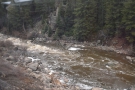 2
2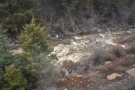 3
3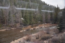 4
4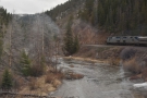 5
5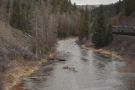 6
6 7
7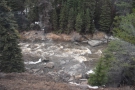 8
8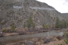 9
9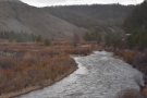 10
10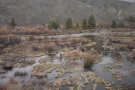 11
11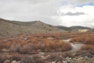 12
12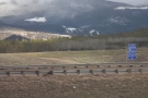 13
13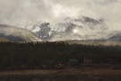 14
14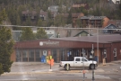 15
15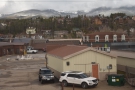 16
16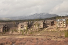 17
17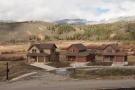 18
18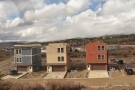 19
19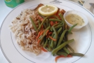 20
20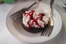 21
21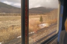 22
22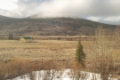 23
23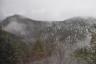 24
24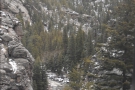 25
25 26
26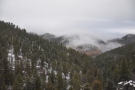 27
27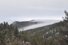 28
28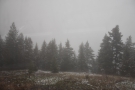 29
29 30
30 31
31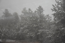 32
32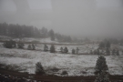 33
33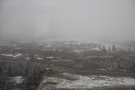 34
34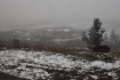 35
35 36
36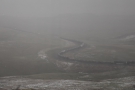 37
37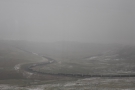 38
38 39
39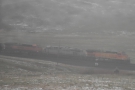 40
40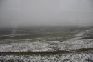 41
41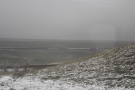 42
42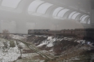 43
43 44
44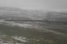 45
45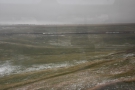 46
46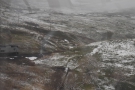 47
47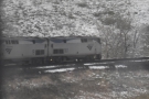 48
48 49
49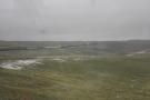 50
50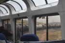 51
51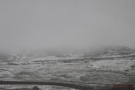 52
52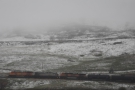 53
53 54
54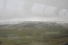 55
55By the time we reached Granby, we were over 90 minutes late, our scheduled arrival time having been 15:12. We’d taken just under four hours to cover the 180 km from Glenwood Springs, a journey that should have taken us three hours, during which time we’d added another 560 m to our elevation, Granby standing at just over 2,400 m.
Granby almost marked the point where we left the Colorado River, which we’d been following all day. The Colorado rises to the northeast of Granby, high in the Rockies above Grand Lake, but we were going south, following the Fraser River. Not long after leaving Granby, the line wound itself way along another steep-sided tree-lined valley, breaking 2,500 m of elevation along the way.
We exited from the top of the canyon into another broad, open valley and, still following the river, met up with our new highway companion, US-40 as together we rolled into Fraser, and our next stop, Fraser-Winter Park at 17:20, still 90 minutes behind schedule. By now, it was time to say goodbye to the Fraser River as well: we were about to cross over the continental divide and onto the eastern side of the Rockies.
To mark the occasion (although it was entirely coincidental), Amanda and I went to dinner, sitting in the dining car as we made the steep climb out of Fraser to an altitude of 2,800 m, where the train took a 90° turn to head east into the Moffat Tunnel, which runs for 10 km under the mountains, which soar another 800 m above the roof of the tunnel. We entered the tunnel’s western portal at 17:40, exiting at 17:49 coming out in a broad alpine valley, with clouds drifting across top.
My dinner, the Atlantic Salmon, arrived shortly after that as we began our descent of the eastern flanks of the Rockies into Denver. Both the landscape and the weather were very different on this side of the Rockies. For starters, it was snowing, while the cloud was also low, often coming down to meet us, which is a shame since I suspect that the views would have been magnificent!
In contrast to our long, slow ascent, effectively following one long river valley, here we left our broad, alpine valley after about 40 minutes and began cutting across the tops of a series of valleys which dropped steeply away below us. These were linked by a series of short tunnels (at least ten) and some were incredibly deep and steep-sided, but very hard to photograph, even when we weren’t inside a cloud! I’d love to come back and travel this stretch when the weather’s good!
An hour after leaving the Moffat Tunnel, the line turned south, with the landscape flattening out a bit, now filled with broad, open valleys. We’d also lost over 800 m in elevation, having just passed the 2,000 m mark. We were now about 50 km east of the tunnel and approaching a massive S bend in the track, where the line curves down the side of the hill, first turning east, then going a full 180° on itself to head back west before turning north, running parallel to the line down from the mountains, which is maybe 200 m further west, and 50 m above. Finally, there’s another 90° curve as the train turns east again and, just like that, we were out of the Rockies
The best part of the descent was that a freight train, on its way up into the mountains, was waiting for us on the curve, which made it really easy to see the course of the line. It had three locomotives at the front, followed by a long line of tankers that disappeared into the gloom, at the end of which I could just make out another two orange locomotives. In all, it took us 100 seconds to pass the train, which, at 48 km/h, makes is around 1.3 km long!
You can see how we got on in Denver after the final gallery.


 1
1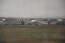 2
2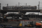 3
3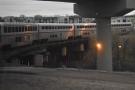 4
4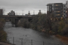 5
5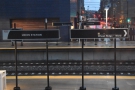 6
6 7
7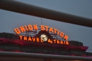 8
8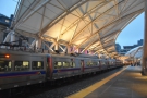 9
9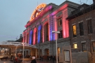 10
10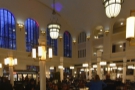 11
11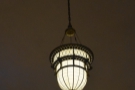 12
12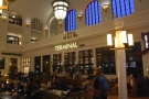 13
13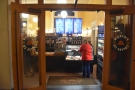 14
14 15
15 16
16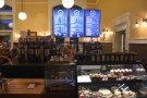 17
17 18
18 19
19 20
20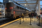 21
21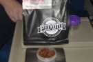 22
22After the excitement of the Rockies, our approach into Denver in the gathering gloom was rather low-key. We covered the remaining 30 km at a relatively slow pace, arriving outside Denver Union Station at 19:40. However, we then had to do a painfully slow manoeuvre where we went past the station, then backed our way in (since Union Station is a dead end, we had to go back out the way we came in).
It was 19:45 when we finally stopped at the platform, just over an hour behind schedule, having managed to make up some time. We were scheduled for a 30-minute stop at Denver, so we got out to stretch our legs, with the crew telling us to be back by 20:10 to be on the safe side.
Union Station has the lines running southwest to northeast, where they exit the station. It serves both the daily Amtrak service and the local Metro Denver commuter trains with several long platforms, which are accessed at the southwestern end. In most sensible stations, the station buildings would be at this end of the platforms, but at Union Station, they stand in front of the platforms on the southern side, so to get there, we had to walk the length of the train, across the end of the platforms and then back up the other side.
However, it was worth it, since the recently renovated building, which was built in the Beaux-Arts style in 1914, is magnificent, with a large, central hall. We took a look around and found, in one corner, Pigtrain Coffee Co, which uses Conscious Coffees from nearby Boulder. Since we didn’t have long and it was late into the evening, I just ordered a decaf cappuccino to go in my RCup, which, all told, was pretty good.
Coffee safely purchased, we went straight back to the train since it’s a good five-minute talk from the main building. however, we needn’t have worried, since there were still people queuing to board when we got back at 20:10. Since we didn’t seem to be going anywhere, we took the opportunity to weight our coffee beans for breakfast the following morning.
We finally crawled out of the station at 20:30 only to stop for five minutes as soon as we’d left, a delay which put us an hour and a half behind schedule again. All told though, it had been a good day: we’d covered just over 600 km in the 12 hours since we’d left Green River, climbing over 1,500 m in the process, with a descent of over 1,000 m for good measure. And, of course, we’d crossed over the Rockies.
We went to bed quite happy, looking forward to a low-key final day as we covered the last 1,600 km to Chicago across the flat terrain of Nebraska, Iowa and Illinois. You can see how we got on in the third and final instalment of this Travel Spot.
Don’t forget that you can share this post with your friends using buttons below, while if you have a WordPress account, you can use the “Like this” button to let me know if you liked the post.