 Welcome to another Travel Spot, part of my series detailing my trip to America from January/February 2017. These particular posts are all about The Grand Adventure, the week-long drive which I took from Phoenix to San Francisco. So far, I’ve described my drive from Phoenix to Joshua Tree National Park, followed by a day hiking in the park and an evening drive in the rain to Los Angeles. After spending a day in the city, I was on my way again, driving along the Californian coast on my way to San Francisco.
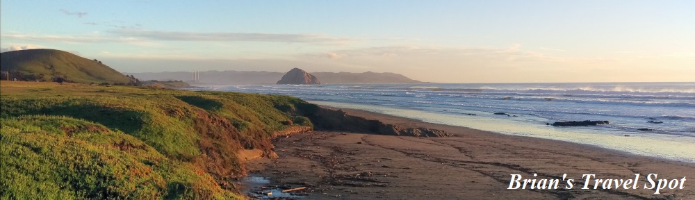
This post, Part III of The Grand Adventure, covers the first part of the drive, from Los Angeles to San Simeon, following SR 1 (the Pacific Coast Highway) and US 101. The route I took followed the coast as much as possible, with some spectacular views along the way. In all, I covered 260 miles which, including stops, took me just over six hours.
I’ve split this post into four parts:
- Along the Pacific Coast Highway to Ventura
- US 101 from Ventura to Buelton
- Back to the Pacific Coast Highway to Morro Bay
- Sunset at Estero Bay
You can see how the first part of the drive went after the gallery.


 end of the beach.")
.")


 1
1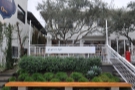 2
2 3
3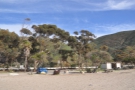 4
4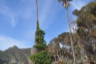 5
5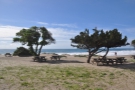 6
6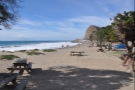 7
7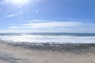 8
8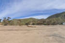 9
9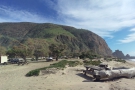 10
10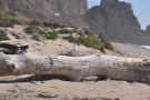 11
11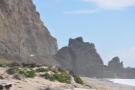 12
12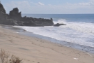 13
13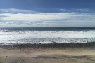 14
14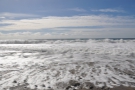 15
15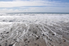 16
16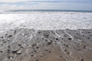 17
17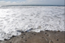 18
18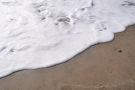 19
19 20
20 21
21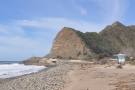 22
22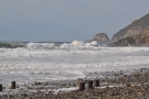 23
23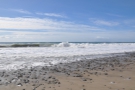 24
24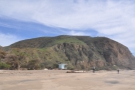 25
25I left Los Angeles on a sunny Tuesday morning, with the goal of arriving in San Francisco on Friday afternoon, when I had to return my trusty hire car. You can easily drive from Los Angeles to San Francisco in day if you take US 101. West of Los Angeles, it runs along the coast in several places, but once you get north of San Luis Obispo, it follows an inland route which runs parallel to the coast.
Since I had four days, I’d decided to take my time and make plenty of stops, so planned a more leisurely route, splitting the drive over three days, with the additional day spent in San Simeon so that I could visit Hearst Castle. Rather than use US 101, I decided to take SR 1, otherwise known as the Pacific Coast Highway, an older route which run directly along the coast in many places, although in the end, I spent more time that I’d planned on US 101.
I began my day at Go Get Em Tiger, where I had my morning coffee, then I was on my way, slightly later than I’d hoped. I drove west along I-10, the freeway which I’d taken to get to Los Angeles on Sunday evening, following it to its terminus at Santa Monica, where I’d been the afternoon before. Here I picked up the Pacific Coast Highway as it heads west, hugging the narrow strip of land between the mountains and the Pacific Ocean.
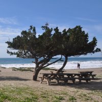
I could have stopped at any number of places along the way to admire the views, but conscious that I had a full day’s drive ahead of me and that I was already late, I limited myself to just one stop at Sycamore Cove Beach, about 30 miles west of Santa Monica. I pulled into the State Park, one of many along this stretch of the coast, and took a 10-minute wander around the beach, which, at noon on a cool January day, I pretty much had to myself.
Then it was back to the car and I was on my way again. Not long after, the Pacific Coast Highway leaves the coast, heading north and joining with US 101 near Oxnard. This was to be a common theme for the first part of the day, with the two highways combining on several occasions.
Oxnard is in a broad, flat-bottomed valley between two mountain ranges, formed by the Santa Clara River as it flows into the Pacific. At this point, I didn’t have a US SIM in my mobile phone, so was navigating by road sign, figuring that I couldn’t really go wrong, following such an obvious route. However, even though I was supposed to be joining US 101, the only major highway in the area, I somehow managed to miss it completely, ending up driving around various local roads before finally finding the highway again. To this day, I still don’t know how I missed it!
Safely back on US 101, I continued west, which you can read about after the gallery.

...")


 at the far end of the beach.")


 1
1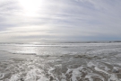 2
2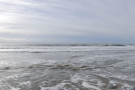 3
3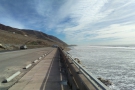 4
4 5
5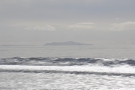 6
6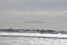 7
7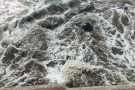 8
8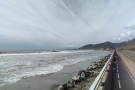 9
9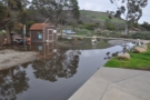 10
10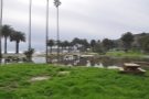 11
11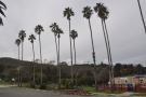 12
12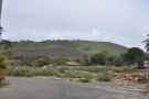 13
13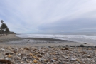 14
14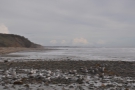 15
15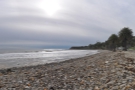 16
16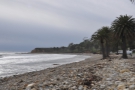 17
17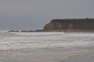 18
18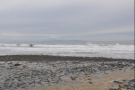 19
19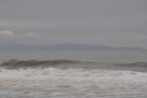 20
20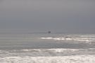 21
21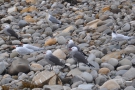 22
22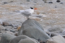 23
23 24
24 25
25The combined US 101 and Pacific Coast Highway carry on west through Ventura, after which the road hugs another narrow coastal strip between the mountains and the sea. Most of the time, the two routes are combined, but there’s a five mile stretch just west of Ventura where the Pacific Coast Highway runs right along the sea front, with US 101 above it and, running between them, the train line which carries Amtrak’s Coast Starlight service (which I took from Los Angeles to San Jose two years later in 2019).
If you want to speed through, stick to US 101, where, being higher up, you’ll get better views. Alternatively, if, like me, you want to stop, drop down to the Pacific Coast Highway as it passes numerous beaches before re-joining US 101 just past Rincon Beach. I had a brief halt at Solimar Beach, spending a few minutes watching the surf pounding the sea wall, then I was on my way again.
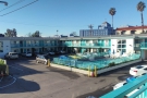
Shortly after the two roads recombine, the coastal strip widens and US 101 runs through the centre of Santa Barbara, re-joining the coast just beyond the airport, to the west of the city. I took another stop about 15 miles further on at Refugio State Beach, where a partially flooded picnic area provided evidence of the rainstorms that had been battering the coast that winter and which were to make their presence felt later on during the drive.
From Refugio State Beach, US 101 continues for another 10 miles along the coast, running parallel to the train tracks, until it reaches Gaviota, where it abruptly turns north, leaving the coast and the railway behind. Shortly afterwards, at Las Cruces, the Pacific Coast Highway and US 101 part company, US 101 carrying on north to take a more inland route, while the Pacific Coast Highway goes via Lompoc and Vandenberg Village, the two coming back together at Pismo Beach, 70 miles away to the northwest.
In the process, both roads cut off a large peninsula where the coast turns to run north. Most of the land is occupied by the massive Vandenberg Air Force base (which you get to see some of from the train, including several SpaceX launch sites). This cuts the Pacific Coast Highway off from the coast, so mindful of the time (it was mid-afternoon by then) and considering that I still had a long way to go, I decided to stay on US 101, since I wouldn’t see any of the coast whichever route I took.
You can see how the rest of the drive went after the gallery.


.")


 1
1 2
2 3
3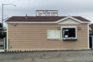 4
4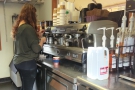 5
5 6
6 7
7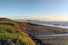 8
8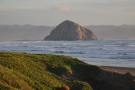 9
9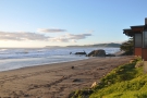 10
10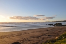 11
11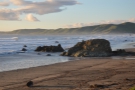 12
12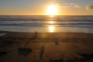 13
13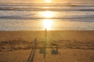 14
14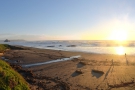 15
15From Las Cruces, US 101 steadily climbs through the hills on its way to Buelton in the Santa Ynez Valley, presenting a very different landscape of rolling, green hills along the way. By then it was three o’clock, so I stopped for a late lunch, getting coffee from a drive-through cabin called the Coffee Cabin. Drive-through coffee is not something I see very often, except when I’m on the west coast, where they seem to be everywhere. I think they’re great fun and always enjoy stopping at them.
I carried on after lunch, leaving US 101 at Los Alamos to take SR 135. This runs west towards Vandenberg Air Force Base where it joins the Pacific Coast Highway, which carries on north through the hills, taking a parallel route to US 101, the two converging at Pismo Beach. I’d gone this way in the hope of more sea views at Oceano and Grover Beach (where the Pacific Coast Highway re-joins the railway) but the road runs just back from the coast, which was hidden behind low dunes.
The combined US 101/Pacific Coast Highway runs a short way alongside San Luis Obispo Bay before cutting north through the hills, following the San Luis Obispo Creek to reach San Luis Obispo itself. From here, the quickest route to San Francisco, 220 miles to the north, is to stay on US 101 which cuts inland, following the route of the railway through the Santa Lucia range to the northeast.
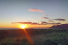
However, I had different plans, picking up the Pacific Coast Highway again, which branches off to the northwest, staying in the valley as it makes it way down to the coast at Morro Bay. By now, it was five o’clock and, with the sun dipping towards the horizon, I took another short break admire the views in the golden light.
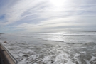
I was still about half an hour’s drive from San Simeon and it was touch and go whether I would make it before dusk, so I pushed on. However, I’d only gone on for another 10 minutes when it became clear that I wasn’t going to reach San Simeon before sunset, so I pulled off at Estero Bay. The road was set back from the beach, so I walked down to the water’s edge to watch the sun sink into the Pacific Ocean for the second night running.
You can see what I made of the sunset after the gallery.


.")


 1
1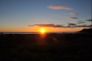 2
2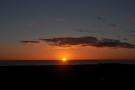 3
3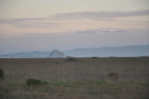 4
4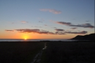 5
5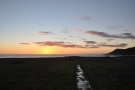 6
6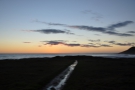 7
7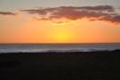 8
8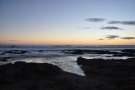 9
9 10
10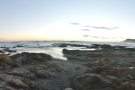 11
11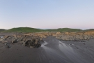 12
12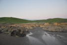 13
13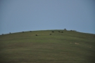 14
14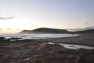 15
15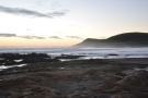 16
16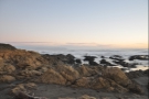 17
17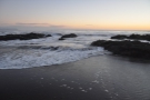 18
18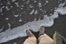 19
19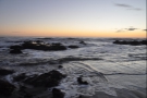 20
20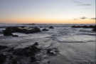 21
21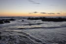 22
22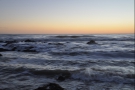 23
23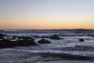 24
24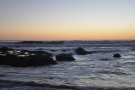 25
25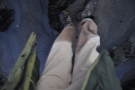 26
26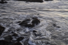 27
27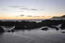 28
28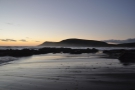 29
29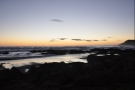 30
30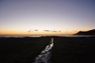 31
31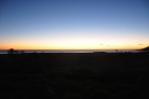 32
32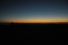 33
33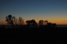 34
34 35
35It was about a five-minute walk down to the beach along a very muddy path, so I changed into my hiking boots (I don’t like to wear them when I’m driving if I can help it). It was about 17:20 when I set off, the sun just above the ocean and sinking fast. Unsurprisingly, I had the beach, which was strewn with rocky outcrops, completely to myself.
I pottered about, taking photos and admiring the views before I did something rather silly. I like to dip my hand in the water whenever I visit the sea, but I don’t like getting my feet wet. I usually do this by standing at the water’s edge, but when the beach is very shallow, it can be quite hard to do, particularly if the waves are anything other than very gentle.
On this particular occasion, with some rather big waves coming in, I didn’t fancy my chances. Abandoning my usual method, I stepped out onto one of the low, rocky outcrops that was already surrounded by water, figuring I could crouch there and dip my fingers into the Pacific Ocean. It worked in that I managed to get my fingers wet, but while I was admiring the views, a really big wave came along and swept right over the rocks and over my feet as well!
Of course, if I’d been sensible, I could have just stood there and, at worst, I would have had wet boots. Instead, I panicked and stepped off the rocks in a forlorn attempt to get back to the dry part of the beach, immediately going up to my calves in cold, cold water. Realising my mistake, I stopped and stood still, which is just as well, otherwise I might have fallen flat on my face.
In a few seconds, the wave had receded and I was able to splosh my way back to the relative dry. I hung around for a little longer to watch the waves and catch the glow of the sun which had, by then, disappeared below the horizon. Then I squelched my way back to the car, where I was able to change into some dry socks and my trainers before driving the remaining 20 minutes to San Simeon in the dark. After checking into my hotel, I finally found a use for the hair drier that’s in every one of my hotel rooms: drying my soaking boots!
This concludes Part III of The Grand Adventure. In the next instalment, you can see what I got up to during my day in San Simeon, including a visit to Hearst Castle, and a rather drastic change of plan.
If you liked this post, please let me know by clicking the “Like” button. If you have a WordPress account and you don’t mind everyone knowing that you liked this post, you can use the “Like this” button right at the bottom instead. [bawlu_buttons]
Don’t forget that you can share this post with your friends using buttons below.