 Welcome to the final instalment of The Grand Adventure, my week-long drive from Phoenix to San Francisco, which I undertook in January 2017. So far, The Grand Adventure has taken me from Phoenix to Los Angeles via the Joshua Tree National Park, followed by a drive along the Pacific Coast Highway, with a stop at Hearst Castle and a detour around the Big Sur due to landslips, which got me as far as Santa Cruz on the northern edge of Monterey Bay.
This last post in the series covers my final day, which started with a quick exploration of Santa Cruz and was followed by the last stretch of the Pacific Coast Highway, which took me north to San Francisco (where the highway continues north over the Golden State Bridge). However, it was the end of the road for me, as I had to return my hire car in downtown San Francisco. In the middle of a very busy Friday afternoon. Which, I’ll be honest, went about as well as could be expected. It was not, I have to say, my finest bit of planning. Before that though, I had some more coast to explore.
You can see how I got on after the gallery.


.")


 fairground...")


, the river is narrower...")


. And then it was time to go.")
 1
1 2
2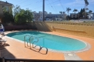 3
3 4
4 5
5 6
6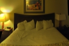 7
7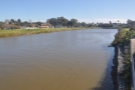 8
8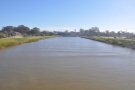 9
9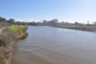 10
10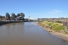 11
11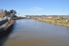 12
12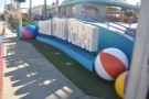 13
13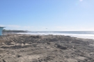 14
14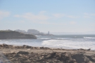 15
15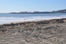 16
16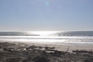 17
17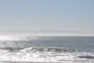 18
18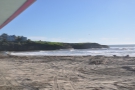 19
19 20
20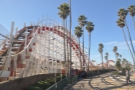 21
21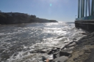 22
22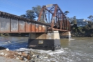 23
23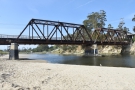 24
24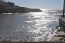 25
25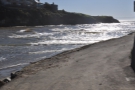 26
26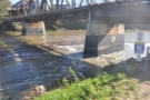 27
27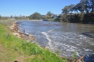 28
28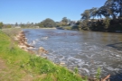 29
29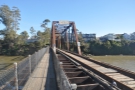 30
30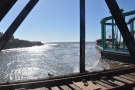 31
31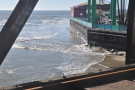 32
32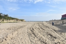 33
33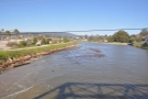 34
34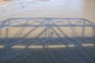 35
35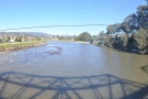 36
36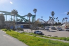 37
37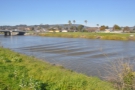 38
38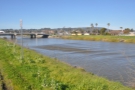 39
39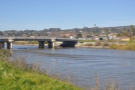 40
40 41
41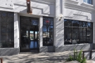 42
42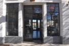 43
43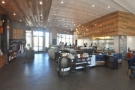 44
44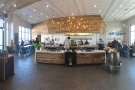 45
45 46
46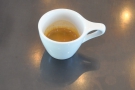 47
47I’d reached Santa Cruz the previous evening at the end of a very long day of driving, covering the last stretch from Monterey around the crescent of Monterey Bay in the dark. Out of all of State Route 1 (aka the Pacific Coast Highway, although at this point it’s confusingly known as the Cabrillo Highway) that I’d driven, it was one part which I didn’t mind missing since it’s mostly set back from the coast, and, I suspect, offers little in the way of views (at least compared to what I’d experienced before). It was also a nice, straight, flat drive, easily done at night.
Just as I had on my first night on the road, I spent the night in a Super 8, a basic motel which at least had functioning Wifi and a decent free breakfast. I’d chosen the location without a great deal of thought, but actually ended up nicely situated on the banks of the San Lorenzo River, a short way from the beach in one direction and the centre of town in the other. Had I been staying longer, it would have made the perfect base from which to explore.
As it was, I allowed myself a couple of hours to get a feel for Santa Cruz, a delightful little seaside town (and one which I returned to, along with Amanda and Karen, the friend I had just made on Instagram, a couple of years later for a more extensive visit). I began with a quick look at the San Lorenzo River, then took a five-minute stroll due south to the beach, which, on a windy Friday morning in January, I largely had to myself.
I wandered through the (closed) fairground and boardwalk, full of shuttered stalls, which lined the back of the beach, getting as far as the railroad bridge over the river. From there, I strolled back to the hotel along the Santa Cruz Riverwalk which runs along both sides of the river and picked up my car.
One option was the hit the road there and then, but I couldn’t leave Santa Cruz without visiting Verve Coffee Roasters, which is based in the city and came highly recommended by Karen. Back then, although I had come across Verve as a roaster, I didn’t know much about the company. Since then I’ve gone on to visit Verve coffee shops in places as far flung as San Francisco to the north, Los Angeles to the south, and across the Pacific in Tokyo and Kamakura! So instead of hitting the road immediately, I drove into the centre of downtown Santa Cruz to visit Verve’s flagship location on Pacific Avenue.
Suitably fortified (and impressed), I headed back to the car and re-joined State Route 1 which runs in a big loop, cutting through Santa Cruz north of downtown. From there, it heads west along the northern shore of Monterey Bay, then north along the coast all the way to San Francisco.
You can see what I got up to on the drive after the gallery.


 to north (right).")
 rock.")


...")


 side of the lighthouse, looking back...")


.")


 1
1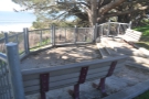 2
2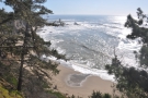 3
3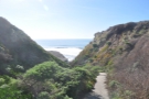 4
4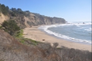 5
5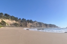 6
6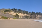 7
7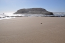 8
8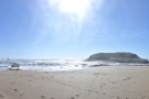 9
9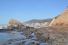 10
10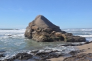 11
11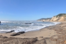 12
12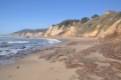 13
13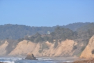 14
14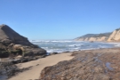 15
15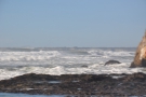 16
16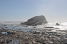 17
17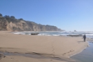 18
18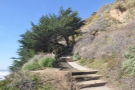 19
19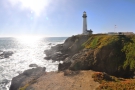 20
20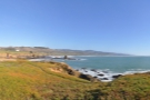 21
21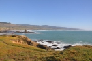 22
22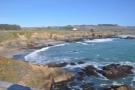 23
23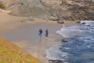 24
24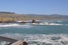 25
25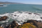 26
26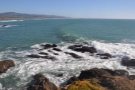 27
27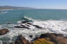 28
28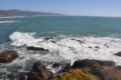 29
29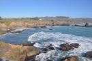 30
30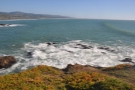 31
31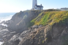 32
32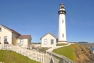 33
33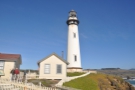 34
34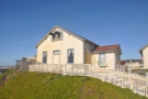 35
35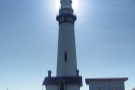 36
36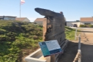 37
37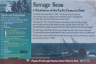 38
38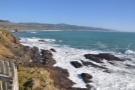 39
39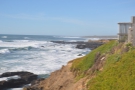 40
40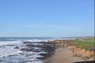 41
41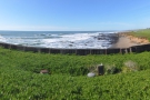 42
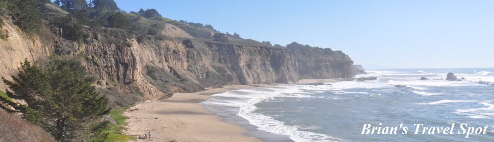
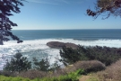
42From Santa Cruz, State Route 1 follows the coastline for 70 miles, all the way up to Daly City on the southern edge of San Francisco, where it briefly merges with I-280. The coastline becomes steadily less spectacular the further north you go, but the first stretch, just outside Santa Cruz, is pretty impressive, causing me to pull over after 25 minutes at the Greyhound Rock County Park.
This overlooks a sweeping beach, backed by tall cliffs, one of a series which punctuate the coast as you go west then north from Santa Cruz. Meanwhile, the aforementioned (and very distinctive) Greyhound Rock stands just offshore. From the parking lot, a path leads down to the beach, which, once again, I pretty much had to myself. I spent half an hour there, admiring the views and the pristine beach, before heading back to the car and setting off once more.
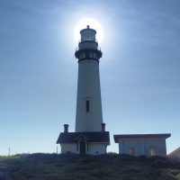
As you might have guessed, I didn’t get very far, managing just 10 minutes in the car before I reached Pigeon Point Lighthouse, standing prominently on a headland. I enjoy visiting lighthouses, but hadn’t managed one on the trip thus far. Sensing that this might be my last opportunity, I pulled over and drove down the access road, only to find that, for once, I’d managed to visit somewhere popular.
Not finding a place in the (admittedly fairly small) car park, I followed the lead of several other visitors and parked on the access road. I took in the sweep of the coast from a purpose-built viewing platform, then went exploring the lighthouse buildings. Ironically, having thought it was my last chance to visit a lighthouse on this trip, I ended up returning a few days later with my friend Richard, when he stopped at Pigeon Point to catch the sunset.
The lighthouse, which was built in 1871, is still in use today, having been automated in 1974, making it one of the oldest active lighthouses on the California coast. You used to be able to take tours of the lighthouse, but sadly these stopped in 2001. However, you can stay in the old lighthouse keepers’ housing, which, since the mid-1960s, has served as a youth hostel.
If you are wondering about the name, by the way, Pigeon Point has nothing to do with an avian infestation. It’s named after the American clipper, Carrier Pigeon, which was wrecked off the coast on her maiden voyage in 1853. Not that the construction of the lighthouse has stopped the wrecks since many a ship has met its end on the rocks over the years.
Since I was a little short on time, I only stayed for about 15 minutes before heading back to the car and pushing on for the final part of my drive to San Francisco.
My plan, which involved driving into downtown San Francisco on a Friday afternoon, had seemed so sensible when I’d come up with it, although I suspect that with a little forethought (let alone hindsight) I should have seen the flaws. I was going to spend an extended weekend with my friends in San Jose and, looking back, the sensible thing would have been to arrange to drop the car off at somewhere like San Jose Airport (which is on the city’s light rail network) and leave it at that.
However, on my only previous visit to San Francisco in 2005, I’d hired a car and gone north over the Golden State Bridge on State Route 1, the start of a week-long drive to Seattle. As a result, I had this idea that I would drive up State Route 1 and over the Golden Gate Bridge, effectively ending this journey where I had started the previous one.
Then I’d turn around and come back into the city, having arranged to spend a night in a downtown hotel so that I could have the following day to visit coffee shops before heading down to San Jose. The plan was to swing by the hotel on my way back from the Golden Gate Bridge to drop my luggage off, then I’d drop the hire car off and I’d be done. Simple.
I left Pigeon Point at half past two, from where it was a 50-mile drive to the Golden Gate Bridge, which should have taken about an hour, leaving me plenty of time to get back into the city before the car hire place shut at five o’clock. Well, that was the theory. Except I had planned to do all of this on a Friday afternoon. Can you see the flaw yet?
You can find out how well my plan worked out after the gallery.
 miles.")


...")


 1
1 2
2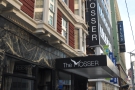 3
3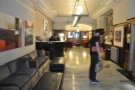 4
4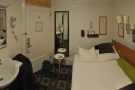 5
5 6
6 7
7 8
8 9
9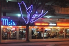 10
10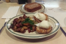 11
11At first, things went well, and I made good progress along the coast. However, once I was past Pedro Point and Rockaway Beach, I reached the southern suburbs of San Francisco. The traffic slowed as I approached the merge with I-280, but I figured that it was just the merge itself that was holding things up. However, as I left I-280 (which heads northeast into the heart of downtown) and carried on north along State Route 1, it was clear that things were not going according to plan.
By now, the road was thoroughly urban, with houses on either side. Although it was three or four lanes in each direction, there were traffic lights at every intersection and there was an intersection at every block. What had been a relatively free-flowing (if slow) ride, even through the I-280 merge, now became a stop-start affair, sometimes taking a couple of cycles of the lights to get through each intersection.
By the time I’d hit the section through Golden Gate Park (along with all the other San Franciscans heading north for the weekend), traffic had come to a halt, crawling along a short way every few minutes. Realising that I would probably never make it to the Golden Gate Bridge and back in time (back, actually, was unlikely to be a problem; getting there was the issue) I bailed as I left the park and took the first available right where I started to make good time going against the traffic.
From there, downtown was pretty much a straight drive to the east and I was beginning to think (other than the absurd idea of trying to drive over the Golden Gate Bridge and back on a Friday afternoon) that my plan wasn’t so bad after all. Then I hit downtown San Francisco. Oh my. What a dumb idea!
I don’t like driving in cities at the best of times. Big, spread out places like Phoenix are fine. But cities like San Francisco? With multiple one-way streets and turn restrictions? And pedestrians everywhere? And with so much traffic? No way. They stress me out as it is, and it was ten times worse on a Friday afternoon! What was I thinking?
It took me an hour of driving around that damn city trying to get to the car hire place. I knew exactly where it was, but could I get there? No. I’d get to the top of the street, but it was one-way, and I was at the wrong end. So, round I’d go again. I’d get to the other end, but turning from the street I was on was prohibited. So, round I’d go again. And I’d often have to go several blocks before I could turn back on myself to have another go. And all this took time, because there were lights at every intersection and, in America, if you’re turning, pedestrians have right of way, even if your light is green, so I’d often have to wait a couple of cycles.
Worse still, I had no US data on my phone, so had no real-time satellite navigation. In the end, I pulled up at the curb outside a Starbucks, where I knew my phone would jump on the Wifi, got the navigation app up and downloaded the directions, which finally guided me in. By then, I’d given up on the idea of swinging by the hotel; I just wanted to get rid of the damn car!
However, I had one final indignity to go. I needed to return the car with the tank full, which I had completely forgotten about until I drove up the ramp of the car hire place. In the past, I’ve been stung by car hire firms which will do anything to charge you extra, but I’ll say this for Hertz: the guy at the downtown location was an angel.
I was supposed to drop the car off at five o’clock and it was already close to that.
“No worries”, he said, “I’m here until eight.”
He told me where the nearest petrol (gas) station was. Now that I knew what I was doing, it was a fairly straightforward drive there and back, so off I went and filled up. It was only when I was almost back at the car hire place that I looked at the fuel gauge and saw that it was only reading about three-quarters full! I had filled it up, but clearly the pump had cut out early.
By then I was so stressed that I couldn’t face going around again to fill the car up a second time, so I just drove back to the car hire place. After hearing my explanation, my angel let me off with an “it’s fine” and, with that, The Grand Adventure was over, almost exactly seven days to the hour after I left Phoenix.
I’d driven 1,227 miles (the first photo of the mileage in the gallery was taken at Wickenburg, my first stop after leaving Phoenix) through some amazing and varied landscapes and had the time of my life. And, although The Grand Adventure was over, I still had the rest of my trip to look forward to, starting with a day in San Francisco. That, however, is for another series of posts.
If you liked this post, please let me know by clicking the “Like” button. If you have a WordPress account and you don’t mind everyone knowing that you liked this post, you can use the “Like this” button right at the bottom instead. [bawlu_buttons]
Don’t forget that you can share this post with your friends using buttons below.